| • MLAs (Prov.) |
- Iain Black (BC Lib)
- Diane Thorne (NDP)
- Douglas Horne (BC Lib)
| Area[2] |
| • Total |
122.30 km2 (47.22 sq mi) |
| Elevation |
24 m (79 ft) |
| Population (2011)[3] |
| • Total |
126,840 |
| • Density |
1,034.0/km2 (2,678/sq mi) |
| Time zone |
PST (UTC-8) |
| Postal code span |
V3B to V3K |
| Area code(s) |
+1-604, +1-778 |
| Website |
Coquitlam.ca |
Coquitlam // (2011 census population 126,840)[3] is a city in the Lower Mainland of British Columbia, Canada. Coquitlam, mainly a suburban city, is the sixth-largest city in the province and is one of the 21 municipalities comprising Metro Vancouver. The current mayor of Coquitlam is Richard Stewart.[1]
- 1 History
- 2 Geography
- 2.1 Neighbourhoods
- 2.2 Climate
- 3 Demographics
- 4 Economy
- 5 Government
- 6 Education
- 7 Infrastructure
- 7.1 Transportation
- 7.2 Health care
- 7.3 Police, fire, emergency services
- 8 Culture and contemporary life
- 8.1 Arts and entertainment
- 8.2 Parks and community
- 8.3 Sports and recreation
- 8.4 Media
- 9 Notable residents
- 10 Sister cities
- 11 See also
- 12 References
- 13 External links
The Coast Salish people were the first to live in this area, and archaeology confirms continuous occupation of the territory for at least 9,000 years. The name Kwikwetlem is said to be derived from a Coast Salish term meaning "red fish up the river".[4]
Explorer Simon Fraser came through the region in 1808, and in the 1860s Europeans gradually started settling the area. Coquitlam began as a "place-in-between" with the construction of North Road in the mid-19th century to provide Royal Engineers in New Westminster access to the year-round port facilities in Port Moody.[5]
The young municipality got its first boost in 1889 when Frank Ross and James McLaren opened what would become Fraser Mills, a $350,000, then state-of-the-art lumber mill on the north bank of the Fraser River. The District of Coquitlam was incorporated in 1891. By 1908, a mill town of 20 houses, a store, post office, hospital, office block, barber shop, and pool hall had grown around the mill. A mill manager's residence was built that would later become Place des Arts.[6]
Over the next two years, several contingents of French Canadian mill workers arrived from Quebec, and Maillardville was born. Named for Father Edmond Maillard, a young Oblate from France, it became the largest Francophone centre west of Manitoba. Maillardville's past is recognized today in street names, the Francophone education system and French immersion programs, French-language guides and scouts, and celebrations such as Festival du Bois.[5][7]
Following World War II, Coquitlam and the rest of the Lower Mainland experienced substantial population growth that continues today. The opening of Lougheed Highway in 1953 made the city more accessible and set the stage for residential growth. In 1971, Coquitlam and Fraser Mills were amalgamated, which gave the city a larger industrial base. The mill closed in 2001, and is now rezoned into a residential area.[6][8]
Coquitlam is situated some 10 to 15 km (6.2 to 9.3 mi) east of Vancouver, where the Coquitlam River connects with the Fraser River and extends northeast along the Pitt River toward the Coquitlam and Pitt lakes. Coquitlam borders Burnaby and Port Moody to the west, New Westminster to the southwest, and Port Coquitlam to the southeast. Burke Mountain, Eagle Ridge, and 1,583 m (5,194 ft) tall Coquitlam Mountain form the northern boundary of the city.[9][10][11] Coquitlam's area, 152.5 square kilometres (58.9 sq mi), dwarfs the other communities in the Tri-Cities; it is about six times larger than either Port Moody or Port Coquitlam.[12]
Like Vancouver, Coquitlam is in the Pacific Time Zone (winter UTC−8, summer UTC−7), and the Pacific Maritime Ecozone.[13][14]
Coquitlam's geographic shape can be thought of as a tilted hourglass, with two larger parcels of land with a smaller central section connecting them.
Southwest Coquitlam comprises the original core of the city, with Maillardville and Fraser River industrial sector giving way to the large residential areas of Austin Heights, colloquially referred to as "The Bump" due to its high and flat plateau topography. These older residences, with larger property dimensions, are increasingly being torn down and replaced with newer and larger homes. The Poirier Street area was the city's original recreational centre with the Coquitlam Sports Centre, Chimo Aquatic and Fitness Centre, and sports fields located there, while City Hall was previously located further south in Maillardville.[15]
The Austin Heights area contains Como Lake, a renowned urban fishing and recreation area, and headwaters for the Como watershed. The watershed represents one of the last urban watersheds in the Tri-Cities that supports wild stocks of Coho Salmon as well as other species at risk such as coastal Cutthroat Trout (both sea-run and resident) and bird species such as the Great Blue Heron and Green Heron.[16]
In 1984, the provincial government sold 57 hectares (141 acres) formerly attached to Riverview Hospital to Molnar Developments. Shortly afterward, this land was subdivided and became Riverview Heights, with about 250 single family homes. The remaining 240 acres (0.97 km2) of this still-active mental health facility has been the subject of much controversy between developers, environmentalists, and conservationists. In 2005, the city's task force on the hospital lands rejected the idea of further housing on the lands and declared that the lands and buildings should be protected and remain as a mental health facility.[17]
Coquitlam Town Centre, was designated as a "Regional Town Centre" under the Metro Vancouver’s Livable Region Strategic Plan. The concept of a town centre for the area dates back to 1975, and is intended to have a high concentration of high-density housing, offices, cultural, entertainment and education facilities to serve major growth areas of the region, served by rapid transit service.[15] It is in the town centre that many public buildings can be found, including City Hall, a branch of the Coquitlam Public Library, R.C.M.P. station, Coquitlam's main fire hall, the David Lam Campus of Douglas College, the Evergreen Cultural Centre, City Centre Aquatic Complex, Town Centre Park and Percy Perry Stadium. Coquitlam Town Centre is currently undergoing an update of the Town Centre plan.[18]
In 1989, the provincial government sold 570 hectares (1,409 acres) of second-growth forested land on the south slope of Eagle Mountain, known locally as Eagle Ridge, to developer Wesbild. This resulted in the closure of Westwood Motorsport Park in 1990, and the creation of Westwood Plateau, which was developed into 4,525 upscale homes, as well as two golf courses.[19][20]
With development on Westwood Plateau completed and the opening of the David Avenue Connector in 2006, Coquitlam's primary urban development has now shifted to Burke Mountain in the northeastern portion of the city.[21][22][23]
Coquitlam Land Use (2001) Total 152.5 km2 (37,684 acres):[12]
- Agricultural Land 381.25 ha (942.1 acres)
- Extractive Industry 138.00 ha (341.0 acres)
- Harvesting and Research 0.00 ha (0.0 acre)
- Residential
- Single Family 2,790.75 ha (6,896.1 acres)
- Rural 488.00 ha (1,205.9 acres)
- Town/Low-rise 244.00 ha (602.9 acres)
- High-rise 15.25 ha (37.7 acres)
- Commercial 288.75 ha (713.5 acres)
- Industrial 427.00 ha (1,055.1 acres)
- Institutional 350.75 ha (866.7 acres)
- Transport. Comm., Utilities 274.50 ha (678.3 acres)
- Recreation / Nature Areas 5,429.00 ha (13,415.4 acres)
- Open / Undeveloped 3,080.50 ha (7,612.1 acres)
- GVRD Watershed 1,342.00 ha (3,316.2 acres)
Like the rest of Metro Vancouver, Coquitlam has a maritime temperate climate, enjoying mild temperatures and sufficient precipitation; warm drier summers and wet mild winters. However, unlike other cities in the area, precipitation is especially heavy in Coquitlam due to its proximity to the mountain slopes. With westward air moving off the Pacific Ocean, the air is forced to flow up the Coast Mountains causing it to cool and condense and fall as precipitation, this process is known as orographic precipitation. The orographic effect is mainly responsible for the massive 1,955 mm (77.0 in).) annual average precipitation that Coquitlam receives each year, with most falling as rainfall in the fall and winter months, with 287 mm (11.3 in).) in November; the summer is usually sunny with minimal precipitation with 66 mm (2.6 in).) in August. Although the mild temperatures allow for mostly rain to fall during the winter months, occasionally snow will fall. With slightly higher elevation compare to the rest of Metro Vancouver, Coquitlam can receive an average of 58 cm (23 in).) of snow each year, with it rarely staying on the ground for more than a day or two. On December 29, 1996 over 45 cm of snow fell in just 24 hours.
Coquitlam is also located in the warmest region in Canada where average mean annual temperature is 10 °C (50 °F). Temperatures are warm during the summer months with an average temperature of 22 °C (72 °F) during the day, and 13 °C (55 °F) at night in August; 6 °C (43 °F) during the day, and 1 °C (34 °F) at night in January. This relatively mild climate, by Canadian standards, is caused by the warm Alaska current offshore and the many mountain ranges preventing the cold arctic air from the rest of Canada from reaching the southwest corner of British Columbia; however, occasionally it can fall well below freezing (below -5°C/-10°C) for a day or two during the winter.
| [hide]Climate data for Coquitlam (Port Moody Glenayre) |
| Month |
Jan |
Feb |
Mar |
Apr |
May |
Jun |
Jul |
Aug |
Sep |
Oct |
Nov |
Dec |
Year |
| Record high °C (°F) |
16.5
(61.7) |
19.0
(66.2) |
23.0
(73.4) |
28.0
(82.4) |
34.5
(94.1) |
33.5
(92.3) |
33.5
(92.3) |
34.0
(93.2) |
32.5
(90.5) |
28.0
(82.4) |
19.0
(66.2) |
15.5
(59.9) |
34.5
(94.1) |
| Average high °C (°F) |
5.5
(41.9) |
7.5
(45.5) |
9.9
(49.8) |
12.8
(55) |
16.4
(61.5) |
18.9
(66) |
21.9
(71.4) |
22.3
(72.1) |
19.0
(66.2) |
13.7
(56.7) |
8.3
(46.9) |
5.6
(42.1) |
13.5
(56.3) |
| Daily mean °C (°F) |
3.0
(37.4) |
4.6
(40.3) |
6.5
(43.7) |
9.0
(48.2) |
12.3
(54.1) |
14.8
(58.6) |
17.4
(63.3) |
17.8
(64) |
15.0
(59) |
10.5
(50.9) |
5.9
(42.6) |
3.3
(37.9) |
10.0
(50) |
| Average low °C (°F) |
0.6
(33.1) |
1.6
(34.9) |
3.1
(37.6) |
5.1
(41.2) |
8.2
(46.8) |
10.8
(51.4) |
12.9
(55.2) |
13.3
(55.9) |
10.9
(51.6) |
7.3
(45.1) |
3.5
(38.3) |
0.9
(33.6) |
6.5
(43.7) |
| Record low °C (°F) |
−14
(7) |
−13
(9) |
−7.8
(18) |
−1
(30) |
1.7
(35.1) |
4.4
(39.9) |
6.0
(42.8) |
7.2
(45) |
1.0
(33.8) |
−7
(19) |
−15.5
(4.1) |
−16
(3) |
−16
(3) |
| Precipitation mm (inches) |
249.6
(9.827) |
199.7
(7.862) |
181.4
(7.142) |
142.6
(5.614) |
107.7
(4.24) |
90.2
(3.551) |
67.9
(2.673) |
66.1
(2.602) |
91.1
(3.587) |
186.5
(7.343) |
297.0
(11.693) |
275.6
(10.85) |
1,955.3
(76.98) |
| Rainfall mm (inches) |
227.0
(8.937) |
188.0
(7.402) |
178.6
(7.031) |
142.4
(5.606) |
107.7
(4.24) |
90.2
(3.551) |
67.9
(2.673) |
66.1
(2.602) |
91.1
(3.587) |
186.2
(7.331) |
293.8
(11.567) |
257.8
(10.15) |
1,896.9
(74.681) |
| Snowfall cm (inches) |
22.6
(8.9) |
11.7
(4.61) |
2.8
(1.1) |
0.2
(0.08) |
0
(0) |
0
(0) |
0
(0) |
0
(0) |
0
(0) |
0.2
(0.08) |
3.2
(1.26) |
17.8
(7.01) |
58.4
(22.99) |
| Avg. precipitation days (≥ 0.2 mm) |
18.7 |
16.3 |
17.9 |
14.9 |
14.4 |
12.6 |
8.7 |
8.1 |
10.0 |
16.2 |
20.2 |
18.9 |
176.7 |
| Avg. rainy days (≥ 0.2 mm) |
17.2 |
15.5 |
17.7 |
14.9 |
14.4 |
12.6 |
8.7 |
8.1 |
10.0 |
16.1 |
20.0 |
17.3 |
172.4 |
| Avg. snowy days (≥ 0.2 cm) |
2.7 |
1.9 |
0.79 |
0.10 |
0 |
0 |
0 |
0 |
0 |
0.11 |
0.93 |
3.1 |
9.6 |
| Source: Environment Canada[24] |
| Historical populations |
| Year |
Pop. |
±% |
| 1921 |
2,374 |
— |
| 1931 |
4,871 |
+105.2% |
| 1941 |
7,949 |
+63.2% |
| 1951 |
15,697 |
+97.5% |
| 1956 |
20,800 |
+32.5% |
| 1961 |
29,053 |
+39.7% |
| 1966 |
40,916 |
+40.8% |
| 1971 |
53,073 |
+29.7% |
| 1976 |
55,464 |
+4.5% |
| 1981 |
61,077 |
+10.1% |
| 1986 |
69,291 |
+13.4% |
| 1991 |
84,021 |
+21.3% |
| 1996 |
101,820 |
+21.2% |
| 2001 |
112,890 |
+10.9% |
| 2006 |
114,565 |
+1.5% |
| 2011 |
126,840 |
+10.7% |
| [25][3][26] |
In the 2011 Census, Statistics Canada originally reported that Coquitlam had a population of 126,456 living in 45,553 of its 48,083 total dwellings, a 10.4% change from its 2006 population of 114,565.[2] Statistics Canada subsequently amended the 2011 census results to a population of 126,840 living in 45,743 of its 48,289 total dwellings, a 10.7% change from 2006.[3] With a land area of 122.30 km2 (47.22 sq mi), it had a population density of 1,037.1/km2 (2,686.1/sq mi) in 2011.[2][3]
According to the 2006 Canadian census, there were 114,565 people living in the municipality in 43,241 private dwellings. 37% of households contained a married couple with children, 25% contained a married couple without children, and 22% were one-person households. Of the 32,185 reported families: 77% were married couples with an average of 3.2 persons per family, 15% were lone-parents with an average of 2.5 persons per family, and 8% were common-law couples with an average of 2.6 persons per family. The median age of Coquitlam’s population was 39.0 years, slightly younger than the British Columbia median of 40.8 years. Coquitlam had 82.6% of its residents 15 years of age or older, less than the provincial average of 83.5%.[27] The south part of Coquitlam has a pocket of French speakers.
In the same 2006 census, about 41% of Coquitlam residents were foreign-born, much higher than the 27% foreign-born for the whole of British Columbia. 61% of respondents claimed to not be a visible minority, while the largest visible minorities included Chinese (17.2%), Korean (5.3%), South Asian and West Asian (both 3.7%), and Filipino (2.7%). 58% of respondents list English as their mother tongue, while 96% state having knowledge of English.[27]
Also according to the 2006 census, the median income in 2005 for all families was $67,031, compared to the provincial average of $62,346. 55.7% of respondents 15 years of age and older claim to have a post-secondary certificate, diploma or degree, compared to 52.2% province-wide.[27] The 2001 census found that 20.2% of Coquitlam residents are Protestant and 21.6% are Catholic. 10.8% belong to other Christian denominations, 8.6% are adherents of other religions, and 35% profess no religion.[28]
Only 25.3% of Coquitlam residents who work outside the home work within the city of Coquitlam itself, just over half the provincial average of 48.7% of residents who work within their own municipality, yet 18.2% of Coquitlam residents take public transit or bicycle or walk to work, close to the provincial average of 19.2%.[27]
As a bedroom community, the majority of Coquitlam residents commute to work in Vancouver, Burnaby, and other Metro Vancouver suburbs. Coquitlam's main industrial area lies in the southern Maillardville/Fraser Mills area near the Fraser River. Among the largest employers within Coquitlam are the City of Coquitlam with approximately 850 employees, Art in Motion with approximately 750 employees, and Boulevard Casino with approximately 600 employees.[29][30] Other major employers include Coca-Cola, Sony, and the Marine Propulsion division of Rolls-Royce.[31][32]
In 2007, there were 610 retail businesses in Coquitlam, and these provided 8,765 jobs (27% of all jobs) within the city. Most retail businesses are concentrated around Coquitlam Centre in the Town Centre area, and big-box retailers such as IKEA and The Home Depot in the Pacific Reach areas, with the remainder of the city's retail outlets centered around the Austin Heights and North Road sectors.[33]
The Tri-Cities Chamber of Commerce has over 840 members including businesses, professionals, residents and other community groups, governed by a 14 person volunteer Board of Directors.[34]
Federal - Coquitlam is represented by two federal MP's in the Parliament of Canada. Fin Donnelly (New Democratic Party) represents the New Westminster—Coquitlam riding, while James Moore (Conservative Party) represents Port Moody—Westwood—Port Coquitlam.[35]
Provincial - Coquitlam is represented by three provincial MLA's in the Legislative Assembly of British Columbia. Joe Trasolini (BC NDP) represents the Port Moody-Coquitlam riding, while Douglas Horne (BC Liberals) represents Coquitlam-Burke Mountain, and Diane Thorne (BC NDP) represents Coquitlam-Maillardville.[36]
Municipal - In the 2008 civic election, Richard Stewart was elected as mayor of Coquitlam, and Brent Asmundson, Barrie Lynch, Doug Macdonnell, Fin Donnelly, Mae Reid, Linda Reimer, Selina Robinson and Lou Sekora were all elected to Coquitlam City Council.[1] Fin Donnelly later resigned and Neal Nicholson was elected into Council through a Municipal By-Election. Coquitlam contracts out garbage and recycling services to International Paper Industries for city residents, but local businesses are responsible for their own garbage and recycling arrangements.[37] Coquitlam Lake provides residents with a mountain-fed water source, while the city maintains its own sewage management system.[38]
Judicial - Supreme Court of British Columbia cases in the Lower Mainland are handled through the Vancouver Law Courts. Provincial Court of British Columbia cases were formerly handled through the Coquitlam Provincial Court, but this was closed in 1996 and moved to the new Port Coquitlam Provincial Court.[39][40]
Coquitlam is served by School District 43 Coquitlam, and offers four public secondary schools, several more middle schools, and dozens of elementary schools. Francophone education in the Tri-Cities is offered by Conseil Scolaire Francophone de la Colombie-Britannique.[41][42]
Coquitlam Town Centre is home to the 4,000-student David Lam Campus of Douglas College, which offers university transfer, career-training and academic-upgrading programs. Therapeutic Recreation, Hotel and Restaurant Management, and Animal Health Technology programs are housed in the original main campus building. The $39 million Health Sciences Centre opened in 2008, with state-of-the-art facilities for Nursing, Psychiatric Nursing and other health-career programs.[43]
There are two major universities, University of British Columbia and Simon Fraser University, located in the nearby municipalities. The British Columbia Institute of Technology (BCIT) in neighbouring Burnaby provides polytechnic education and grants degrees in several fields. Vancouver is also home to the Emily Carr University of Art and Design and the Vancouver Film School.[44]
The Coquitlam Public Library has two branches: City Centre and Poirier. The library has a collection of over 240,000 items, and an annual budget of over $4 million.[45]
[show]
- v ·
- t ·
- e
|
| Secondary schools |
- Centennial ·
- Dr. Charles Best ·
- Gleneagle ·
- Heritage Woods ·
- Pinetree ·
- Port Moody ·
- Riverside ·
- Terry Fox
|
|
| Middle or junior high schools |
- Banting ·
- Citadel ·
- Como Lake ·
- Hillcrest ·
- Kwayhquitlum ·
- Maillard ·
- Maple Creek ·
- Minnekhada ·
- Montgomery ·
- Moody ·
- Pitt River ·
- Scott Creek ·
- Summit
|
| Primary or elementary schools |
- Alderson ·
- Aspenwood ·
- Baker Drive ·
- Birchland ·
- Blakeburn ·
- Bramblewood ·
- Cape Horn ·
- Castle Park ·
- Cedar Drive ·
- Central ·
- College Park ·
- Coquitlam River ·
- Eagle Ridge ·
- Glen ·
- Glenayre ·
- Hampton Park ·
- Harbour View ·
- Hazel Trembath ·
- Heritage Mountain ·
- Irvine ·
- James Park ·
- Kilmer ·
- Leigh ·
- Lord Baden-Powell ·
- Mary Hill ·
- Meadowbrook ·
- Miller Park ·
- Millside ·
- Moody ·
- Mountain Meadows ·
- Mountain View ·
- Mundy Road ·
- Nestor ·
- Panorama Heights ·
- Parkland ·
- Pinetree Way ·
- Pleasantside ·
- Porter Street ·
- R.C. MacDonald ·
- Ranch Park ·
- Riverview Park ·
- Rochester ·
- Roy Stibbs ·
- Seaview ·
- Vanier ·
- Walton ·
- Westwood
|
| Private schools |
- Archbishop Carney ·
- Our Lady of the Assumption ·
- Our Lady of Fatima ·
- Queen of All Saints ·
- Traditional Learning Academy ·
- Hope Lutheran School
Coquitlam is served by TransLink, which is responsible for both public transit and major roads. There is regular bus service on numerous lines running throughout the city and connecting it to other municipalities in Metro Vancouver, with a major exchange at Coquitlam Central Station. The 97 B-Line express bus service connects the central part of the city to the Lougheed Town Centre SkyTrain station in neighbouring Burnaby.[46]
The West Coast Express, with a stop at Coquitlam Central Station, provides commuter rail service west to downtown Vancouver and east as far as Mission.[47] WCE operates Monday to Friday only (excluding holidays), with five trains per day running to Vancouver in the morning peak hours and returning through Coquitlam in the evening peak hours. There are two additional runs via "TrainBus" in the morning (after all trains) and three in the evening (after all trains). There are also three Trainbus departures in each direction on Saturdays and two on Sundays.[48]
Beginning in summer 2016, Coquitlam will be served by the Evergreen Line, a 10.9 km (6.8 mi) long extension of TransLink's SkyTrain system, using Bombardier's Advanced Rapid Transit technology, at a cost of $1.4 billion. The Evergreen Line will run from the Coquitlam Town Centre area, through Coquitlam Central Station and into Port Moody, re-entering Coquitlam on North Road and finally joining the existing SkyTrain system at Lougheed Town Centre. The Evergreen Line is expected to replace the 97 B-Line.[49]
For motorists, the Trans-Canada Highway provides freeway access to Burnaby, Vancouver, Surrey, and other municipalities in the Lower Mainland. Lougheed Highway is an alternative route to the Trans-Canada, entering Coquitlam through Maillardville, past the Riverview Hospital area, up to Coquitlam Centre where it turns sharply east to Port Coquitlam. Barnet Highway begins at the Coquitlam Centre area and heads directly east through Port Moody and on to Burnaby and downtown Vancouver.[50]
Coquitlam has 13.1 km of bike routes, including dedicated bike lanes on Guildford Way, David Avenue, and Chilko Drive, plus additional routes through city parks.[51] Future bike routes have been identified for Lougheed Highway and for the southern Maillardville area near the Fraser River.[52]
Coquitlam is served by two international airports. Vancouver International Airport, located on Sea Island in the city of Richmond to the west, is the second busiest in Canada and provides most of the air access to the region. Abbotsford International Airport, located to the east, is the sixth busiest airport in Canada. Nearby Pitt Meadows Airport provides services for smaller aircraft[53][54] and there are also Boundary Bay Airport and Langley Airport for small aircraft.
Greyhound Canada has a bus depot in south Coquitlam for both passenger and package service.[55]
Residents and visitors wishing to travel to Vancouver Island, the Gulf Islands, and other destinations along the Inside Passage may use the BC Ferries car and passenger ferry service from two terminals in the communities of Tsawwassen and Horseshoe Bay, south and north of Vancouver respectively. BC Ferries operates the Queen of Coquitlam, a C class ferry capable of carrying 362 cars and 1,466 passengers, which was launched in 1976. She received an $18 million rehabilitation in November 2002, and currently operates as a secondary vessel on the Departure Bay-Horseshoe Bay route.[56]
Coquitlam is served by Fraser Health, which operates the 106-bed Eagle Ridge Hospital on the Port Moody/Coquitlam city boundary. ERH opened its doors in 1984 and operates a 24-hour emergency department, ambulatory, long-term care and acute care programs. It is a Centre of Excellence for elective surgery for urology, gynaecology, plastics and orthopedics. The hospital also offers public education clinics for asthma, diabetes, rehabilitation services and programs for cardiology, children's grief recovery, youth crisis response and early psychosis prevention.[57]
Fraser Health also operates the 352-bed Royal Columbian Hospital just south of Coquitlam in New Westminster. Coquitlam residents are also served by many privately owned health care clinics, while Tri-Cities Health Services operates 653 residential care beds.[58]
Coquitlam is also the home of Riverview Hospital, a large mental health facility, operating under the governance of BC Mental Health & Addiction Services. Riverview opened in 1913 and had 4,630 patients at its peak, but advances in treatment and cutbacks in funding have resulted in fewer people receiving mental health care, and much of the facility has closed over the last few decades.[59]

Coquitlam RCMP's Main Detachment Building
Coquitlam contracts out its police service to the Royal Canadian Mounted Police, with the main police station adjacent to City Hall at Coquitlam Town Centre and community police stations in the Austin Heights and Burquitlam areas. The Coquitlam RCMP detachment also serves the municipalities of Anmore, Belcarra, and Port Coquitlam.[60]
Coquitlam has its own fire service, known as Coquitlam Fire and Rescue, with three main fire halls and three auxiliary stations. The main fire halls are at Town Centre, Austin Heights and Mariner Way near Mundy Park. The auxiliary halls are on Burke Mountain, Mariner Station, and Austin station.[61]
Like all other municipalities in British Columbia, Coquitlam's ambulance service is run by the British Columbia Ambulance Service.[62]
Coquitlam Search and Rescue is a volunteer search and rescue team operating under the Provincial Emergency Program. Coquitlam SAR is responsible for urban and wilderness search and rescue for the area between Indian Arm and Pitt Lake, and encompasses the local communities of Port Coquitlam, Port Moody, Belcarra and Anmore. The SAR team is based at Town Centre Fire Hall.[63]
Being in close proximity to Vancouver and surrounded by the rest of the Lower Mainland, Coquitlam residents have access to virtually unlimited choice in cultural and leisure activities. Within the city itself are numerous venues that bring these choices closer to home.
Coquitlam was designated as a Cultural Capital of Canada in 2009 by the Department of Canadian Heritage.[64]
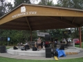
A partnership of the city, the arts community, private business and senior governments, the Evergreen Cultural Centre in the Town Centre area is a venue for arts and culture, a civic facility designed to host a wide variety of community events. It features a 264-seat black box theatre, rehearsal hall, art studios and art gallery. Evergreen serves as the home venue for the Pacific Symphonic Wind Ensemble, the Coastal Sound Music Academy, and the Stage 43 Theatrical Society. Nearby proscenium theatres include the 336-seat Terry Fox Theatre in Port Coquitlam, and the 206-seat Inlet Theatre in Port Moody.[65]
Place des Arts is a non-profit teaching arts centre in Maillardville founded in 1972, offering programs in visual arts, music, acting, and dance. It features specialized programs for school students and home learners, and presents concerts and exhibitions for the public. Studios are offered for pottery, fibre arts, yoga, ballet, drama, piano, drawing and painting. Place des Arts offers four faculty concerts throughout the year, as well as numerous recitals and presentations by students on an ongoing basis.[66]
Place Maillardville is a community centre providing leisure activities for all age groups, with programs on French language, culture, as well as physical activities. Heritage Square offers visitors a wealth of historic sites, gardens, a bike path, and an outdoor amphitheatre; it is also home to the Mackin Heritage Home & Toy Museum.[67]
The 1074-seat Red Robinson Show Theatre opened as part of a $30 million expansion to Boulevard Casino in 2006, while Cineplex Entertainment operates the 4,475-seat SilverCity Coquitlam movie complex with 20 screens.[68][69][70]
Coquitlam has a considerable number of open green spaces, with the total area of over 890 hectares (2,200 acres). There are over 80 municipal parks and natural areas, with Mundy Park located roughly in the centre of the city being the biggest, and Ridge Park located in the highlands near the city's northern edge. Pinecone Burke Provincial Park, Minnekhada Regional Park, and Pitt Addington Marsh are on the northern and eastern border of the city, while the restricted area of the Metro Vancouver's Coquitlam watershed border Coquitlam to the north. Colony Farm is a 404 hectare park that straddles the Coquitlam and Port Coquitlam boundaries, offering walking trails rich with wildlife and gardens. Town Centre Park is a large city park located in the central area of the city, it provides city residents with many recreational activities.[71][72]
Coquitlam does not have any beaches within the city limits, but the Tri-Cities offers freshwater beaches in neighbouring Anmore (Buntzen Lake, Sasamat Lake) and saltwater beaches in Belcarra and Port Moody.[73]
Numerous yearly festivals are staged at various locations throughout Coquitlam,[74] including Festival du Bois (first full weekend in March),[75] the Water's Edge Festival (third full weekend in March),[76] Como Lake Fishing Derby (last Sunday in May),[77] BC Highland Games (last Saturday in June),[78] and the Blue Mountain Music Festival (mid-July).[79]
Professional sports teams in the area include the Vancouver Canucks (National Hockey League), BC Lions (Canadian Football League), Vancouver Whitecaps FC (Major League Soccer), and the Vancouver Canadians (Northwest League baseball). The 2010 Winter Olympics were also staged in the Metro Vancouver and Whistler areas.[80]
The city is responsible for the maintenance of numerous sports and recreation fields, including 40 grass/sand/soil sports fields, five FieldTurf fields, 35 ball diamonds, several all-weather surfaces, a bowling green, a croquet/bocce court, and a cricket pitch.[81] The city also operates Percy Perry Stadium and the Coquitlam Sports Centre.[82] Privately owned Planet Ice features 4 additional ice rinks, and more rinks are found throughout the Tri-Cities.[83]
The city manages four all-age community centres (Centennial, Pinetree, Poirier, Summit), and two senior community centres (Dogwood Pavilion, Glen Pine Pavilion).[84]
Baseball - The Coquitlam Reds of the B.C. Premier Baseball League play their home games at Mundy Park;[85] the Reds' most famous alumnus is former Major League All-Star and National League MVP Larry Walker.[86][87] Coquitlam is also home to Coquitlam Little League, which has been part of Little League International since 1955; Coquitlam finished 3rd at the 1984 Little League World Series.[88] In 2008, Coquitlam hosted the Junior League Canadian Championships.[89]
Basketball - Coquitlam is home to the Tri City Youth Basketball Association; formed in 1999, it serves the Tri-Cities with over 1,400 players from grades 2 to 9.[90] The program is part of the Steve Nash Youth Basketball program administered by Basketball BC. It is open to both boys and girls, and operates out of school gyms across the Tri-Cities area.[91][92]
Cricket - Coquitlam is home to the Windies Cricket Club. The club consists of over 40 members with 3 adult teams playing in the Premier, Second & Fifth Divisions. The club is affiliated with the British Columbia Mainland Cricket League and games are played at Mackin Park. A youth Kanga Cricket Program was formed with the aim of promoting and growing the game of cricket in Coquitlam. The SuperStrikers cricket team is open to boys and girls aged 6 – 16.[93][94]
Football - Coquitlam is home to the Coquitlam Minor Football Association, which is a member of the Vancouver Mainland Football League. CMFA players range from 6 to 18 years of age, and play against teams from the Lower Mainland and Vancouver Island. Coquitlam was also the home of the Tri-City Bulldogs of the Canadian Junior Football League from 1991-2004.[95]
Golf - In addition to courses in neighbouring communities in the Tri-Cities, Coquitlam itself is home to several golf facilities. The Vancouver Golf Club, located in southwest Coquitlam, has hosted two major LPGA tour events as well as one Senior PGA Tour event. The Westwood Plateau Golf & Country Club is one of the highest rated golf courses in Canada. Both the Westwood Plateau Golf Academy and Eaglequest Golf Centre are designed as executive learning courses.[96]
Hockey - Founded in 2001, the Coquitlam Express of the British Columbia Hockey League play at the Coquitlam Sports Centre.[97][98][99] Coquitlam is also home to the Coquitlam Minor Hockey Association, a AAA club in the Greater Vancouver area in the Pacific Coast Division, with almost 1000 members from Initiation Hockey 1 to Juvenile.[100]
Lacrosse - Coquitlam is home to the Coquitlam Adanacs of the Western Lacrosse Association, who play at the Coquitlam Sports Centre, and to the Coquitlam Minor Lacrosse Association.[101] In July 2008, Percy Perry Stadium hosted the 2008 ILF Under-19 World Lacrosse Championships.
Motorsports - Coquitlam was formerly home to Westwood Motorsport Park, Canada's first purpose-built permanent road course, located on what is now Westwood Plateau. The first race was held in 1959, and over the years hosted many different professional series including Formula Atlantic and Trans-Am. Notable drivers to have raced at Westwood include Formula One World Champion Keke Rosberg, Indianapolis 500 winners Bobby Rahal and Danny Sullivan, Gilles Villeneuve and Michael Andretti. The track finally closed in 1990 due to encroaching development.[102]
Soccer - The city is home to two major soccer associations, including the Coquitlam Metro-Ford Soccer Club which has over 2500 players that range from Under-5 to adult teams including the Women's Premier team which plays in the Pacific Coast Soccer League,[103] and the North Coquitlam United Soccer Club.[104]
Swimming - City Centre Aquatic Complex is an indoor aquatic centre built in the Town Centre area at a cost of $8.2 million and opened in 1994. CCAC features a 50m Olympic size swimming pool, wave pool, waterslide, 3,000-square-foot (280 m2) fitness centre, and physiotherapy clinic. The Chimo Aquatic and Fitness Centre opened in 2008 in the Austin Heights area at a cost of $19.5 million, replacing the older Chimo Pool nearby.[105] CAFC features a 25m swimming pool, a 20m lap pool, leisure pool, and fitness room. Coquitlam also operates three outdoor swimming pools (Eagle Ridge, Rochester, Spani), two outdoor wading pools (Blue Mountain, Mackin), and three outdoor splash pads (Blue Mountain, Panorama, Town Centre).[106]
Track and Field - Coquitlam is home to the Coquitlam Cheetahs track and field club, who train at Percy Perry Stadium, which was named after their former coach who died in 2005.
In addition to the other Metro Vancouver media outlets, CKPM-FM was the first radio station dedicated to the Tri-Cities area when it took to the air in 2009.[107]
Coquitlam is served by two bi-weekly newspapers, the Tri-City News and Coquitlam Now.[108]
A significant number of movie and television productions have been partly or completely filmed in Coquitlam in recent years, including both New Moon and Eclipse from the Twilight series, The X-Files, Juno, Smallville, The Sisterhood of the Traveling Pants, Dark Angel, The Day the Earth Stood Still, Romeo Must Die, Watchmen.[109] The city maintains the Coquitlam Film Office to coordinate permits, traffic and crowd control, and insurance for film and television productions.[110]
As part of the promotion for The Simpsons Movie, the 7-Eleven chain of convenience stores converted 12 of their stores in North America to Kwik-E-Marts. Eleven of these stores were located throughout the United States; the lone Canadian store was the Coquitlam location at the corner of Guildford Way and Lansdowne Drive, across from Gleneagle Secondary School, Eagle Ridge Pool, and Scott Creek Middle School. During a local television story for the promotion, it was announced that Coquitlam was chosen because it was very "Springfield-like".[111]
|
| | | | | |


 49°17′02″N 122°47′31″W / 49.28389°N 122.79194°W / 49.28389; -122.79194Coordinates:


 Eason's School Experience in Coquitlam
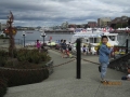
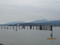
 Alaska Cruise (7) - Returning to Vancouver