Victoria, British Columbia 이미지 검색결과 더보기 »
| Victoria, British Columbia | |||
|---|---|---|---|
| City | |||
| City of Victoria | |||
 | |||
| |||
| Motto: Semper Liber (Latin) (Translation: "Forever free") | |||
 | |||
| Coordinates: | |||
| Country | Canada | ||
| Province | British Columbia | ||
| Regional District | Capital | ||
| Incorporated | Aug 2, 1862[1] | ||
| Government | |||
| • Mayor | Dean Fortin (past mayors) | ||
| • Governing body | Victoria City Council | ||
| • MP | Murray Rankin | ||
| • MLAs | Carole James, Rob Fleming, Maurine Karagianis | ||
| Area[2] | |||
| • City | 19.47 km2 (7.52 sq mi) | ||
| • Metro | 696.15 km2 (268.79 sq mi) | ||
| Elevation | 23 m (75 ft) | ||
| Population (2011)[3] | |||
| • City |
80,032 (67th) | ||
| • Density | 4,109.4/km2 (10,643/sq mi) | ||
| • Metro | 344,630 (15th) | ||
| • Metro density | 495/km2 (1,280/sq mi) | ||
| Time zone | PST (UTC-8) | ||
| Postal code span | V0S, V8N-V8Z, V9A-V9E | ||
| Area code(s) | 250, 778, and 236 | ||
| NTS Map | 092B06 | ||
| GNBC Code | JBOBQ | ||
| Website | victoria.ca | ||


Victoria /vɪkˈtɔriə/ is the capital city of British Columbia, Canada and is located on the southern tip of Vancouver Island off Canada's Pacific coast. The city has a population of about 80,017 within the metropolitan area of Greater Victoria, which has a population of 344,615, making it the 15th most populous Canadian urban region.
Victoria is about 100 kilometres (62 miles) from BC's largest city of Vancouver on the mainland. The city is about 100 kilometres (62 miles) from Seattle by airplane, ferry, or the Victoria Clipper passenger-only ferry which operates daily, year round between Seattle and Victoria and 40 kilometres (25 miles) from Port Angeles, Washington by Coho ferry across the Strait of Juan de Fuca.
Named after Queen Victoria of the United Kingdom and, at the time, British North America, Victoria is one of the oldest cities in the Pacific Northwest, with British settlement beginning in 1843. The city has retained a large number of its historic buildings, in particular its two most famous landmarks, the British Columbia Parliament Buildings (finished in 1897 and home of the Legislative Assembly of British Columbia) and the Empress hotel (opened in 1908). The city's Chinatown is the second oldest in North America after San Francisco's. The region's Coast Salish First Nations peoples established communities in the area long before non-native settlement, possibly several thousand years earlier, which had large populations at the time of European exploration. Victoria, like many Vancouver Island communities, continues to have a sizable First Nations presence, composed of peoples from all over Vancouver Island and beyond.
Known as the "City of Gardens", Victoria is an attractive city and a popular tourism destination with a thriving technology sector that has risen to be its largest revenue-generating private industry.[4] The city has a large non-local student population, who come to attend the University of Victoria, Camosun College, Royal Roads University, the Sooke Schools International Programme and the Canadian College of Performing Arts. Victoria is very popular with boaters with its beautiful and rugged shorelines and beaches. Victoria is also popular with retirees, who come to enjoy the temperate and usually snow-free climate of the area as well as the usually relaxed pace of the city.
Contents
[hide]- 1 History
- 2 Geography
- 2.1 Geology
- 2.2 Climate
- 3 Neighbourhoods of Victoria
- 4 Demographics
- 4.1 Population
- 4.2 Age distribution
- 4.3 Ethnic origins
- 4.4 Visible minorities and aboriginal population
- 5 Economy
- 5.1 Technology industry
- 5.2 Tourism industry
- 5.3 Social conditions
- 6 Culture
- 7 Attractions
- 8 Sports
- 8.1 Notable sports teams
- 8.2 Notable defunct teams
- 9 Recreation
- 10 Infrastructure
- 11 Education
- 12 Media
- 13 Notable people
- 14 Sister cities
- 15 See also
- 16 References
- 17 External links
- Burnside/Gorge
- Downtown
- Fairfield
- Fernwood
- Gonzales (Foul Bay)
- Harris Green
- Hillside-Quadra
- James Bay
- Jubilee (North/South)
- North Park
- Oaklands
- Rockland
- Victoria West
- Chinatown
- Rock Bay
- Oak Bay Border (Foul Bay Road)
- Songhees (part of Vic West)
- Selkirk
- Victoria Capitals (Canadian Baseball League)
- Victoria Cougars (Western Hockey League)
- Victoria Vistas (Canadian Soccer League)
- Victoria Seals (Golden Baseball League)
- Victoria Salmon Kings (ECHL)
History[edit]
Prior to the arrival of European navigators in the late 1700s, the Victoria area was home to several communities of Coast Salish peoples, including the Songhees. The Spanish and British took up the exploration of the northwest Coast of North America beginning with the visits of Juan Perez in 1774 and of Captain James Cook in 1778 although the Victoria area of the Strait of Juan de Fuca was not penetrated until 1790. Spanish sailors visited Esquimalt Harbour (just west of Victoria proper) in 1790, 1791, and 1792.
In 1841 James Douglas was charged with the duty of setting up a trading post on the southern tip of Vancouver Island, upon the recommendation by Sir George Simpson that a new more northerly post be built in case Fort Vancouver fell into American hands (see Oregon boundary dispute). Douglas founded Fort Victoria, on the site of present-day Victoria, British Columbia in anticipation of the outcome of the Oregon Treaty in 1846, extending the British North America/United States border along the 49th parallel from the Rockies to the Strait of Georgia.
Erected in 1843 as a Hudson's Bay Company trading post on a site originally called Camosun (the native word was "camosack", meaning "rush of water")[citation needed] known briefly as "Fort Albert", the settlement was renamed Fort Victoria in 1846, in honour of Queen Victoria.[5] The Songhees established a village across the harbour from the fort. The Songhees' village was later moved north of Esquimalt. When the crown colony was established in 1849, a town was laid out on the site and made the capital of the colony. The Chief Factor of the fort, James Douglas was made the second governor of the Vancouver Island Colony (Richard Blanshard was first governor, Arthur Edward Kennedy was third and last governor), and would be the leading figure in the early development of the city until his retirement in 1864.
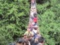
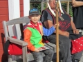
 Wawadit'la, also known as Mungo Martin House, a Kwakwaka'wakw "big house", with totem pole. Built by Chief Mungo Martin in 1953. Located at Thunderbird Park in Victoria, British Columbia.[6]
With the discovery of gold on the British Columbia mainland in 1855, Victoria became the port, supply base, and outfitting centre for miners on their way to the Fraser Canyon gold fields, mushrooming from a population of 300 to over 5000 literally within a few days. Victoria was incorporated as a city in 1862.[7] In 1865, Esquimalt was made the North Pacific home of the Royal Navy, and remains Canada's west coast naval base. In 1866 when the island was politically united with the mainland, Victoria was designated the capital of the new united colony instead of New Westminster - an unpopular move on the Mainland - and became the provincial capital when British Columbia joined the Canadian Confederation in 1871. Memoirs still in print of those early days include those by painter Emily Carr.
In the latter half of the 19th century, the Port of Victoria became one of North America's largest importers of opium, serving the opium trade from Hong Kong and distribution into North America. Opium trade was legal and unregulated until 1865, then the legislature issued licences and levied duties on its import and sale. The opium trade was banned in 1908.
In 1886, with the completion of the Canadian Pacific Railway terminus on Burrard Inlet, Victoria's position as the commercial centre of British Columbia was irrevocably lost to the City of Vancouver. The city subsequently began cultivating an image of genteel civility within its natural setting, aided by the impressions of visitors such as Rudyard Kipling, the opening of the popular Butchart Gardens in 1904 and the construction of the Empress Hotel by the Canadian Pacific Railway in 1908. Robert Dunsmuir, a leading industrialist whose interests included coal mines and a railway on Vancouver Island, constructed Craigdarroch Castle in the Rockland area, near the official residence of the province's lieutenant-governor. His son James Dunsmuir became premier and subsequently lieutenant-governor of the province and built his own grand residence at Hatley Park (used for several decades as Royal Roads Military College, now civilian Royal Roads University) in the present City of Colwood.
A real estate and development boom ended just before World War I, leaving Victoria with a large stock of Edwardian public, commercial and residential buildings that have greatly contributed to the City's character. A number of municipalities surrounding Victoria were incorporated during this period, including the Township of Esquimalt, the District of Oak Bay, and several municipalities on the Saanich Peninsula. Since World War II the Victoria area has seen relatively steady growth, becoming home to two major universities. Since the 1980s the western suburbs have been incorporated as new municipalities, such as Colwood and Langford, which are known collectively as the Western Communities.
Greater Victoria periodically experiences calls for the amalgamation of the thirteen municipal governments within the Capital Regional District.[8] The opponents of amalgamation state that separate governance affords residents a greater deal of local autonomy. The proponents of amalgamation argue that it would reduce duplication of services, while allowing for more efficient use of resources and the ability to better handle broad, regional issues and long-term planning.[citation needed]
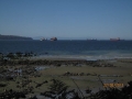
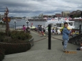
 A panorama of Victoria harbour facing the Empress Hotel
Geography[edit]
Geology[edit]
The landscape of Victoria was formed by water in various forms. Pleistocene glaciation put the area under a thick ice cover, the weight of which depressed the land below present sea level. These glaciers also deposited stony sandy loam till. As they retreated, their melt water left thick deposits of sand and gravel. Marine clay settled on what would later become dry land. Post-glacial rebound exposed the present-day terrain to air, raising beach and mud deposits well above sea level. The resulting soils are highly variable in texture, and abrupt textural changes are common. In general, clays are most likely to be encountered in the northern part of town and in depressions. The southern part has coarse-textured subsoils and loamy topsoils. Sandy loams and loamy sands are common in the eastern part adjoining Oak Bay. Victoria's soils are relatively unleached and less acidic than soils elsewhere on the British Columbia Coast. Their thick dark topsoils denoted a high level of fertility which made them valuable for farming until urbanization took over.
Climate[edit]
Victoria Climate chart (explanation) J F M A M J J A S O N D 9473729447115291362616821181014201120201227191151148999510973Average max. and min. temperatures in °C Precipitation totals in mm Source: Environment Canada[9] [show]Imperial conversion J F M A M J J A S O N D 3.745372.847391.851401.15643161470.864500.668520.868531.16551257463.949414.34538Average max. and min. temperatures in °F Precipitation totals in inches Victoria has a temperate climate with mild, rainy winters and cool, dry and sunny summers. The Köppen climate classification places it at the northernmost limits of the cool, dry-summer subtropical zone (Csb) or cool-summer Mediterranean climate, due to its dry summers.[10] Other climate classification systems, such as Trewartha, place it firmly in the Oceanic zone (Do).[11]
At the Victoria Gonzales weather station, daily temperatures rise above 30 °C (86 °F) on average less than one day per year and fall below 0 °C (32.0 °F) on average only ten nights per year. Victoria has recorded completely freeze-free winter seasons four times (in 1925/26, 1939/40, 1999/2000, and 2002/03).1999 is the only year on record without a single occurrence of frost. During this time the city went 718 days without freezing, starting on December 23, 1998 and ending December 10, 2000. The second longest frost-free period was a 686 day stretch covering 1925 and 1926, marking the first and last time the city has gone the entire season without dropping below 1°C (34°F).[12]
During the winter, the average daily high and low temperatures are 8 and 4 °C (46.4 and 39.2 °F), respectively. The summer months are also relatively mild, with an average high temperature of 20 °C (68 °F) and low of 11 °C (51.8 °F), although inland areas often experience warmer daytime highs. The highest temperature ever recorded in Victoria was 36.0 °C (96.8 °F) on July 11, 2007,[13] while the coldest temperature on record was −15.7 °C (3.7 °F) on December 29, 1968. The average annual temperature varies from a high of 11.4 °C (52.5 °F) that was set in 2004 to a low of 8.6 °C (47.5 °F) set in 1916.[12]
 Colourful flowers bedeck the genteel "Garden City" downtown
Thanks to the rain shadow effect of the nearby Olympic Mountains, Victoria is the driest location on the British Columbia coast. Total annual precipitation is just 608 mm (23.9 in) at the Gonzales weather station in Victoria, compared with 3,671 mm (144.5 in) at Port Renfrew, just 80 km (50 mi) away on the southwest coast of Vancouver Island. Victoria also gets significantly less precipitation than nearby Vancouver, with 1,589 mm (63 in), or Seattle, with 970 mm (38.2 in). Even the Victoria Airport, 25 km (16 mi) north of the city, receives about 45 per cent more precipitation than the city proper.
One of the most striking features of Victoria's climate is that it has distinct dry and rainy seasons. Nearly two-thirds of the annual precipitation falls during the four wettest months, November to February. Precipitation in December, the wettest month (109 mm or 4.3 in) is nearly eight times as high as in July, the driest month (14 mm or 0.55 in). Victoria experiences the driest summers in Canada (outside of the extreme northern reaches of the Northwest Territories and Nunavut).[14]
Victoria averages just 26 cm (10.2 in) of snow annually, about half that of Vancouver. Every few decades Victoria receives very large snowfalls, including the record breaking 100 cm (39.4 in) of snow that fell in December 1996. That amount places Victoria 3rd for biggest snowfall among major cities in Canada. On the other hand, roughly one-third of winters see virtually no snow, with less than 5 cm (1.97 in) falling during the entire season. When snow does fall, it rarely lasts long on the ground. Victoria averages just two or three days per year with at least 5 cm (1.97 in) of snow on the ground.
With 2,193 hours of bright sunshine annually, Victoria is the sunniest place in British Columbia with the exception of Cranbrook.[13] On July, 1958, during the hottest summer in provincial history, Victoria received 424.6 hours of sunshine, which is the most sunshine ever recorded in any month in British Columbia history. This record has since been broken on July 2013, with 432.8 hours of sunshine.[15] Often there is a break in the clouds over the Victoria area. Pilots use this "hole in the clouds" as a navigation aid, referring to it as the "blue hole".
[show]Climate data for Victoria International Airport Month Jan Feb Mar Apr May Jun Jul Aug Sep Oct Nov Dec Year Record high °C (°F) 16.1
(61)18.3
(64.9)21.4
(70.5)26.3
(79.3)31.5
(88.7)33.5
(92.3)36.3
(97.3)34.4
(93.9)31.1
(88)27.6
(81.7)18.3
(64.9)16.1
(61)36.3
(97.3)Average high °C (°F) 7.6
(45.7)8.8
(47.8)10.8
(51.4)13.6
(56.5)16.9
(62.4)19.9
(67.8)22.4
(72.3)22.4
(72.3)19.6
(67.3)14.2
(57.6)9.7
(49.5)7
(45)14.4
(57.9)Daily mean °C (°F) 4.6
(40.3)5.1
(41.2)6.8
(44.2)9
(48)12.1
(53.8)14.9
(58.8)16.9
(62.4)16.8
(62.2)14.2
(57.6)10
(50)6.4
(43.5)4
(39)10
(50)Average low °C (°F) 1.5
(34.7)1.3
(34.3)2.6
(36.7)4.3
(39.7)7.2
(45)9.8
(49.6)11.3
(52.3)11.1
(52)8.6
(47.5)5.7
(42.3)3
(37)1.1
(34)5.6
(42.1)Record low °C (°F) −15.6
(3.9)−15
(5)−10
(14)−3.9
(25)−1.1
(30)2.1
(35.8)4.1
(39.4)4.4
(39.9)−1.1
(30)−4.4
(24.1)−13.3
(8.1)−14.4
(6.1)−15.6
(3.9)Precipitation mm (inches) 143.2
(5.638)89.3
(3.516)78.4
(3.087)47.9
(1.886)37.5
(1.476)30.6
(1.205)17.9
(0.705)23.8
(0.937)31.1
(1.224)88.1
(3.469)152.6
(6.008)142.5
(5.61)882.9
(34.76)Rainfall mm (inches) 132.8
(5.228)83
(3.27)75.2
(2.961)47.5
(1.87)37.5
(1.476)30.6
(1.205)17.9
(0.705)23.8
(0.937)31.1
(1.224)88
(3.46)148.4
(5.843)129.7
(5.106)845.3
(33.28)Snowfall cm (inches) 10.9
(4.29)6.3
(2.48)3.4
(1.34)0.4
(0.16)0
(0)0
(0)0
(0)0
(0)0
(0)0.2
(0.08)4.7
(1.85)13.7
(5.39)39.7
(15.63)Mean monthly sunshine hours 70.8 95.5 145.3 191.3 241.5 251.7 318.1 297.5 228.6 136.9 72.8 58.9 2,108.8 Source: [16]  Victoria's Harbour with Songhees condominiums in the background
Victoria's equable climate has also added to its reputation as the "City of Gardens". The city takes pride in the many flowers that bloom during the winter and early spring, including crocuses, daffodils, early-blooming rhododendrons, cherry and plum trees. Every February there is an annual "flower count" in what for the rest of the country and most of the province is still the dead of winter.
Due to its mild climate, Victoria and its surrounding area (southeastern Vancouver Island, Gulf Islands, and parts of the Lower Mainland and Sunshine Coast) are also home to many rare, native plants found nowhere else in Canada, including Quercus garryana (Garry oak), Arctostaphylos columbiana (Hairy manzanita), and Canada's only broad-leaf evergreen tree, Arbutus menziesii (Pacific madrone). Many of these species exist here, at the northern end of their range, and are found as far south as central and southern California and even parts of Mexico.
Non-native plants grown in Victoria include the cold-hardy palm Trachycarpus fortunei, which can be found in gardens and public areas of Victoria. One of these Trachycarpus palms stands in front of City Hall.[17]
Neighbourhoods of Victoria[edit]
 The main dome of the British Columbia Parliament Buildings, topped with a gold-covered statue of Captain George Vancouver
The following is a list of neighbourhoods in the City of Victoria, as defined by the city planning department.[18] For a list of neighbourhoods in other area municipalities, see Greater Victoria, or the individual entries for those municipalities.
Informal neighbourhoods include:
Demographics[edit]
Population[edit]
Historical populations Year Pop. ±% 1871 3,270 — 1881 5,925 +81.2% 1891 16,841 +184.2% 1901 20,816 +23.6% 1911 31,660 +52.1% 1921 38,727 +22.3% 1931 39,082 +0.9% 1941 42,907 +9.8% 1951 51,331 +19.6% 1961 54,941 +7.0% 1971 61,761 +12.4% 1981 64,379 +4.2% 1991 71,228 +10.6% 1996 73,504 +3.2% 2001 74,125 +0.8% 2006 78,057 +5.3% 2011 80,017 +2.5% [19] The population of the City of Victoria was 80,017 in 2011. The Victoria Census Metropolitan Area, comprising thirteen municipalities informally referred to as Greater Victoria, has a population of 344,615 and is the largest urban area on Vancouver Island.[20] By population, Greater Victoria is the 15th largest metropolitan area in Canada. The Capital Regional District, which includes additional rural areas, has a total population of 345,164.
Age distribution[edit]
Victoria is known for its disproportionately large retiree population. Some 6.4 percent of the population of Victoria and its surrounding area are more than 80 years of age—the highest proportion for any of Canada's metropolitan areas. The city also boasts the country's third-highest concentration of people 65 and older (17.8 per cent), behind only Peterborough, Ontario, and Kelowna, British Columbia.[21] Retirees throughout Canada are drawn to Victoria's mild climate, beautiful scenery, year-round golf season, and generally easy-going pace of life. A historically popular cliché referring to the city was that it is for "the newly wed and nearly dead".[22]
Ethnic origins[edit]
Note: These categories are those used by Statistics Canada.
[show]Ethnic Origin[23] Population[24] Percent of 75,398[25] English 31,545 41.84% Scottish 21,205 28.12% Irish 16,785 22.26% Canadian 14,500 19.23% German 10,365 13.75% French 7,935 10.52% Dutch (Netherlands) 3,395 4.50% Chinese 3,315 4.40% Ukrainian 3,285 4.40% North American Indian 3,230 4.29% Welsh 2,920 3.87% Polish 2,660 3.53% Norwegian 2,440 3.24% British Isles, n.i.e.[26] 2,360 3.13% Italian 2,280 3.02% Swedish 2,080 2.76% American 1,920 2.55% Russian 1,840 2.44% Danish 1,320 1.75% Austrian 1,180 1.57% Filipino 1,055 1.40% Spanish 1,050 1.39% Métis 1,015 1.35% Jewish 990 1.31% Japanese 985 1.31% East Indian 915 1.21% Hungarian (Magyar) 890 1.18% Swiss 660 0.88% Belgian 635 0.84% Finnish 630 0.84% Czech 585 0.78% Portuguese 550 0.73% Romanian 500 0.66% Icelandic 485 0.64% Korean 400 0.53% Croatian 295 0.39% African, n.i.e. 275 0.36% Australian 270 0.36% Greek 265 0.35% Mexican 255 0.34% European, n.i.e. 235 0.31% Vietnamese 225 0.30% Scandinavian, n.i.e. 210 0.29% Serbian people 210 0.29% Iranian 195 0.26% Lebanese 190 0.25% South African 185 0.25% Acadian 175 0.23% Lithuanian 170 0.23% Yugoslav, n.i.e. 160 0.21% Jamaican 155 0.21% Chilean 155 0.21% Latvian 155 0.21% Black 155 0.21% Taiwanese 150 0.20% Slovenian 140 0.19% Ethiopian 130 0.17% Czechoslovakian 115 0.15% Slovak 115 0.15% New Zealander 115 0.15% Argentinian 95 0.13% Turk 95 0.13% Barbadian 90 0.12% Trinidadian/Tobagonian 90 0.12% Estonian 90 0.12% Arab, n.i.e. 90 0.12% Cambodian 85 0.11% Indonesian 80 0.11% West Indian 75 0.10% Flemish 75 0.10% Egyptian 75 0.10% Thai 75 0.10% Inuit 70 0.09% Guyanese 65 0.09% Salvadorean 65 0.09% Oromo 65 0.09% Punjabi 65 0.09% Hawaiian 65 0.09% Maltese 55 0.07% Armenian 55 0.07% Colombian 50 0.07% Gypsy (Roma) 50 0.07% Manx 45 0.06% Brazilian 45 0.06% Maya 45 0.06% Venezuelan 45 0.06% Albanian 45 0.06% Ghanaian 45 0.06% Somali 45 0.06% Byelorussian 40 0.05% Syrian 40 0.05% Pakistani 40 0.05% Sri Lankan 40 0.05% Laotian 40 0.05% Fijian 40 0.05% Aboriginal from Central/South America 35 0.05% Bulgarian 35 0.05% Sicilian 35 0.05% Burmese 35 0.05% Malaysian 35 0.05% Māori 35 0.05% Newfoundlander 30 0.04% Peruvian 30 0.04% Tigrian 30 0.04% South Asian, n.i.e. 30 0.04% Mongolian 30 0.04% Québécois 25 0.03% Dominican, n.o.s.[27] 25 0.03% Caribbean, n.i.e. 25 0.03% Belizean 25 0.03% Guatemalan 25 0.03% Panamanian 25 0.03% Latin, Central or South American, n.i.e. 25 0.03% Frisian 25 0.03% Bosnian 25 0.03% Eritrean 25 0.03% Moroccan 25 0.03% Cornish 20 0.03% Other provincial or regional groups 20 0.03% Basque 20 0.03% Zimbabwean 20 0.03% Afghan 20 0.03% Ecuadorian 15 0.02% Luxembourger 15 0.02% Slav (European) 15 0.02% Amhara 15 0.02% Zulu 15 0.02% Libyan 15 0.02% Azerbaijani 15 0.02% Bengali 15 0.02% Grenadian 10 0.01% Puerto Rican 10 0.01% Kosovar 10 0.01% Montenegrin 10 0.01% Guinean, n.o.s. 10 0.01% Kenyan 10 0.01% Mauritian 10 0.01% Rwandan 10 0.01% Tatar 10 0.01% Bangladeshi 10 0.01% Visible minorities and aboriginal population[edit]
Canada 2011 Census Population % of Total Population Visible minority group
Source:[28]South Asian 1,160 1.5% Chinese 2,895 3.8% Black 850 1.1% Filipino 1,155 1.5% Latin American 505 0.7% Arab 340 0.4% Southeast Asian 460 0.6% West Asian 290 0.4% Korean 355 0.5% Japanese 470 0.6% Other visible minority 90 0.1% Mixed visible minority 415 0.5% Total visible minority population 8,985 11.8% Aboriginal group
Source:[29]First Nations 3,325 4.4% Métis 1,205 1.6% Inuit 100 0.1% Total Aboriginal population 4,490 5.9% White 62,550 82.3% Total population 76,025 100% Economy[edit]
The city's chief industries are technology, food products, tourism, education, federal and provincial government administration and services.[citation needed] Other nearby employers include the Canadian Forces (the Township of Esquimalt is the home of the Pacific headquarters of the Royal Canadian Navy), and the University of Victoria (located in the municipalities of Oak Bay and Saanich) and Camosun College (which have over 33,000 faculty, staff and students combined). Other sectors of the Greater Victoria area economy include: investment and banking, online book publishing, various public and private schools, food products manufacturing, light aircraft manufacturing, technology products, various high tech firms in pharmaceuticals and computers, engineering, architecture and telecommunications.
Technology industry[edit]
Advanced technology is Victoria's largest revenue producing private industry with $1.95 billion in annual revenues generated by more than 800 tech companies that have over 13,000 direct employees.[30] The annual economic impact of the sector is estimated at more than $2.65 billion per year.[30] With three post secondary institutions, eight federal research labs, and Canada's Pacific Navy Base, Victoria has many of the elements required for a strong technology sector. Victoria has Canada's highest household internet usage and is ranked as "Canada's Smartest City" by Macleans Magazine.[31]
Tourism industry[edit]
 The Sunken Garden at Butchart Gardens
Victoria is a major tourism destination with over 3.5 million overnight visitors per year who add more than a billion dollars to the local economy.[32] As well, an additional 500,000 daytime visitors arrive via cruise ships which dock at Ogden Point near the city's Inner Harbour. The city is also close to Canadian Forces Base Esquimalt, the Canadian Navy's primary Pacific Ocean naval base. Downtown Victoria also serves as Greater Victoria's regional downtown, where many night clubs, theatres, restaurants and pubs are clustered, and where many regional public events occur. Canada Day fireworks displays, Symphony Splash, and many other music festivals and cultural events draw tens of thousands of Greater Victorians and visitors to the downtown core. The Rifflandia and Electronic Music Festival are other music events that draw crowds to the downtown core.
The city and metro region has hosted high-profile sports events including the 1994 Commonwealth Games, the 2009 Scotties Tournament of Hearts, the 2005 Ford World Men's Curling Championship tournament, and 2006 Skate Canada. Victoria co-hosted the 2007 FIFA U-20 World Cup at Royal Athletic Park, and is the venue for the Bastion Square Grand Prix Criterium road cycling race. The city is also a destination for conventions, meetings, and conferences, including a 2007 North Atlantic Treaty Organization military chief of staff meeting held at the Hotel Grand Pacific. Every year, the Swiftsure International Yacht Race attracts boaters from around the world to participate in the boat race in the waters off of Vancouver Island, and the Victoria Dragon Boat Festival brings over 90 teams from around North America. The Tall Ships Festival brings sailing ships to the city harbour. Victoria also hosts the start of the Vic-Maui Yacht Race, the longest offshore sailboat race on the West Coast.[citation needed]
The Port of Victoria consists of three parts, the Outer Harbour, used by deep sea vessels, the Inner and Upper Harbours, used by coastal and industrial traffic. It is protected by a breakwater with a deep and wide opening. The port is a working harbour, tourist attraction and cruise destination. Esquimalt Harbour is also a well-protected harbour with a large graving dock and shipbuilding and repair facilities.
Social conditions[edit]
In January 2005, a volunteer study by the Victoria Cool Aid Society found the homeless population to be approximately 700 individuals.[33] This was the first homeless count in the city. In 2006, a Times-Colonist news article estimated the homeless population to have increased by 30% in just a few weeks due to the anticipated tourism boom of the 2010 Winter Olympics in Vancouver.[34] In early 2008, an anti-homelessness programme based on a successful Italian programme was introduced to Victoria.[35] As of February 2013, no residents live there yet.[36]
Despite Victoria's reputation as a tourist destination, pervasive homelessness, loitering, and panhandling are serious problems in the downtown area, as is "open-air" drug use.[37][38][39][40][41]
The homeless survey conducted by the Victoria Cool-Aid Society found 50% of the homeless population identify themselves as being of First Nations origin, and the majority of people living on the streets do not receive income assistance from the government.[33]
Culture[edit]
 British Columbia Parliament Buildings
 Totem pole on the Inner Harbour.
The Victoria Symphony, led by Tania Miller, performs at the Royal Theatre and the Farquhar Auditorium of the University of Victoria from September to May. Every BC Day weekend, the Symphony mounts Symphony Splash, an outdoor event that includes a performance by the orchestra sitting on a barge in Victoria's Inner Harbour. Streets in the local area are closed, as each year approximately 40,000 people attend a variety of concerts and events throughout the day. The event culminates with the Symphony's evening concert, with Tchaikovsky's 1812 Overture as the grand finale, complete with cannon fire from Royal Canadian Sea Cadet Gunners from HMCS QUADRA, a pealing carillon and a fireworks display to honour BC Day. Pacific Opera Victoria, Victoria Philharmonic Choir, Canadian Pacific Ballet and Ballet Victoria stage two or three productions each year at the Macpherson or Royal Theatres. The Electronic Music Festival takes place in Centennial Square during the same time period for the BC Day holiday; DJs from various places show off their music skills.
The Bastion Theatre, a professional dramatic company, functioned in Victoria through the 1970s and '80s and performed high quality dramatic productions but ultimately declared bankruptcy in 1988. Reborn as The New Bastion Theatre in 1990 the company struggled for two more years before closing operations in 1992.
The Belfry Theatre started in 1974 as the Springridge Cultural Centre in 1974. The venue was renamed the Belfry Theatre in 1976 as the company began producing its own shows. The Belfry's mandate is to produce contemporary plays with an emphasis on new Canadian plays.
 One of the stone lions that guard the gate at Chinatown in Victoria.
Other regional theatre venues include: Phoenix Theatre student theatre at the University of Victoria, Kaleidoscope Theatre and Intrepid Theatre, producers of the Victoria Fringe Theatre Festival and The Uno Festival of Solo Performance.
The only Canadian Forces Primary Reserve brass/reed band on Vancouver Island is located in Victoria. The 5th (British Columbia) Field Regiment, Royal Canadian Artillery Band traces its roots back to 1864, making it the oldest, continually operational military band west of Thunder Bay, Ontario. Its mandate is to support the island's military community by performing at military dinners, parades and ceremonies, and other events. The band performs weekly in August at Fort Rodd Hill National Historic Site where the Regiment started manning the guns of the fort in 1896, and also performs every year at the Cameron Bandshell at Beacon Hill Park.
The current major sporting and entertainment complex, for Victoria and Vancouver Island Region, is the Save-On-Foods Memorial Centre arena. It replaced the former Victoria Memorial Arena, which was constructed by efforts of World War II veterans as a monument to fallen comrades. World War I, World War II, Korean War, and other conflict veterans are also commemorated. Fallen Canadian soldiers in past, present, and future wars and/or United Nations, NATO missions are noted, or will be noted by the main lobby monument at the Save On Foods Memorial Centre. The arena was the home of the ECHL (formerly known as the East Coast Hockey League) team, Victoria Salmon Kings, owned by RG Properties Limited, a real estate development firm that built the Victoria Save On Foods Memorial Centre, and Prospera Place Arena in Kelowna. The arena is the home of the Victoria Royals Western Hockey League (WHL) team that replaced the Victoria Salmon Kings.
A number of well-known musicians and bands are from Victoria, including Nelly Furtado, David Foster, The Moffatts, Frog Eyes, Johnny Vallis, Jets Overhead, Bryce Soderberg, Swollen Members, Armchair Cynics, Nomeansno, The New Colors, Wolf Parade, The Racoons, Dayglo Abortions and Hot Hot Heat. Due to the proximity to Vancouver and a 6% distance location tax credit, Victoria is used as a filming location for many films, TV shows, and television movies. Some of these films include X2, X-Men: The Last Stand, In the Land of Women, White Chicks, Scary Movie, Final Destination, Excess Baggage, and Bird on a Wire. Television shows such as Smallville, The Dead Zone, and Poltergeist: The Legacy were also filmed there. Canadian director Atom Egoyan was raised in Victoria. Actors Cameron Bright (Ultraviolet, X-Men: The Last Stand, Thank You For Smoking, New Moon) and Ryan Robbins (Stargate Atlantis, Battlestar Galactica, Sanctuary) were born in Victoria. Actor Cory Monteith from the television series Glee was raised in Victoria. Actor, artist, athlete Duncan Regehr of Star Trek: Deep Space Nine was raised in the region.
Victoria resident Stanley Evans has written a series of mysteries featuring a Coast Salish character, Silas Seaweed, who works as an investigator with the Victoria Police Department. Other Victoria writers include Kit Pearson, Robert Wiersema, W. D. Valgardson, Elizabeth Louisa Moresby, Madeline Sonik, Jack Hodgins, Dave Duncan, Bill Gaston, David Gurr, Ken Steacy, Sheryl McFarlane, Carol Shields, and Patrick Lane. Gayleen Froese's 2005 novel Touch is set in Victoria.
Attractions[edit]
 Christ Church Cathedral in Victoria, British Columbia
 Part of Victoria's skyline in May 2006 from Thunderbird Park.
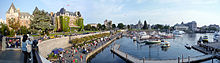 The Inner Harbour is popular with tourists.
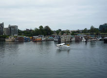 Fisherman's Wharf has a number of houseboats, some of which serve as restaurants.
Beacon Hill Park is the central city's main urban green space. Its area of 75 hectares (190 acres) adjacent to Victoria's southern shore includes numerous playing fields, manicured gardens, exotic species of plants and animals such as wild peacocks, a petting zoo, and views of the Strait of Juan de Fuca and the Olympic Mountains in Washington across it. The sport of cricket has been played in Beacon Hill Park since the mid-19th century.[42] Each summer, the City of Victoria presents dozens of concerts at the Cameron Band Shell in Beacon Hill Park. [43]
The extensive system of parks in Victoria also includes a few areas of natural Garry oak meadow habitat, an increasingly scarce ecosystem that once dominated the region.
In the heart of downtown are the British Columbia Parliament Buildings, The Empress Hotel, Victoria Police Department Station Museum, the gothic Christ Church Cathedral, and the Royal British Columbia Museum/IMAX National Geographic Theatre, with large exhibits on local Aboriginal peoples, natural history, and modern history, along with travelling international exhibits. In addition, the heart of downtown also has the Emily Carr House, Victoria Bug Zoo, Market Square and the Pacific Undersea Gardens, which showcases marine life of British Columbia. The oldest (and most intact) Chinatown in Canada is located within downtown. The Art Gallery of Greater Victoria is located close to downtown in the Rockland neighbourhood several city blocks from Craigdarroch Castle built by industrialist Robert Dunsmuir and Government House, the official residence of the Lieutenant-Governor of British Columbia.
Numerous other buildings of historic importance or interest are also located in central Victoria, including: the 1845 St. Ann's Schoolhouse; the 1852 Helmcken House built for Victoria's first doctor; the 1863 Temple Emanuel, the oldest synagogue in continuous use in Canada; the 1865 Angela College built as Victoria's first Anglican Collegiate School for Girls, now housing retired nuns of the Sisters of St. Ann; the 1871 St. Ann's Academy built as a Catholic school; the 1874 Church of Our Lord, built to house a breakaway congregation from the Anglican Christ Church cathedral; the 1890 St. Andrew's Presbyterian Church;[44] the 1890 Metropolitan Methodist Church (now the Victoria Conservatory of Music), [45] which is publicly open for faculty, student, and guest performances, also acts as Camosun College Music Department; the 1892 St. Andrew's Cathedral; and the 1925 Crystal Gardens, originally a saltwater swimming pool, restored as a conservatory and most recently a tourist attraction called the B.C. Experience, which closed down in 2006.
Attractions outside the City of Victoria[edit]
CFB Esquimalt navy base, in the adjacent municipality of Esquimalt, has a base museum dedicated to naval and military history, located in the Naden part of the base.[citation needed]
North of the city on the Saanich Peninsula are the marine biology Shaw Ocean Discovery Centre, Butchart Gardens, one of the biggest tourist and local resident attractions on Vancouver Island, as well as the Dominion Astrophysical Observatory, part of the National Research Council of Canada, Victoria Butterfly Gardens and Centre of the Universe planetarium.[46] Notable museums in Victoria include the Royal British Columbia Museum,the Maritime Museum of British Columbia and the British Columbia Aviation Museum located on the north edge of the Victoria International Airport. There are also numerous National Historic Sites in close proximity to Victoria, such as the Fisgard Lighthouse, Craigflower Manor and Schoolhouse, Hatley Castle and Hatley Park and Fort Rodd Hill, which is a coastal artillery fort built in the late 1890s, located west of the city in Colwood. Also located west of the city is Western Speedway, a 4/10th-mile oval vehicular race track and the largest in Western Canada.
Sports[edit]
Steve Nash, twice Most Valuable Player in the National Basketball Association, grew up in Victoria. Michael Saunders, outfielder for the Seattle Mariners was born in Victoria and still lives there during the off season. Baseball pitcher Rich Harden of the Oakland Athletics is from Victoria. Professional racing cyclist and 2012 Giro d'Italia winner, Ryder Hesjedal was born in Victoria and still calls the city home. Maddie Secco was born in Victoria and is currently a part of the women's national field hockey who just recently went to India for the Olympic Trials. Olympic Games athletes Riley Mccormick, Silken Laumann, Ryan Cochrane, and Simon Whitfield reside or were born in Victoria.
In 1994 Victoria hosted the Commonwealth Games. Victoria was also the first city location of the cross Canada 2010 Winter Olympics torch relay that occurred before the start of the 2010 Winter Olympics. The 2007 FIFA U-20 World Cup was co-hosted by Victoria along with five other Canadian cities/municipalities (Burnaby, Toronto, Edmonton, Ottawa, Montreal).
The Victoria Cougars are perhaps the most famous sports franchise the city has known, winning the Stanley Cup as members of the PCHA in 1925. The team then moved to Detroit under the name of the Detroit Cougars before the team changed its name to the current Detroit Red Wings of the NHL. Today a Junior 'B' team of that name plays in the Vancouver Island Junior Hockey League. There was also a team called the Victoria Cougars in the Western Hockey League, but they are now the Prince George Cougars.
Victoria Highlanders FC have the distinction of being the only spectator soccer club north of Mexico (in continental America) to be majority owned by its supporters and community.[47]
Victoria is also a rugby hotbed due to its moderate climate and British influence.[48][49]
Notable sports teams[edit]
Notable defunct teams[edit]
Recreation[edit]
Victoria's climate, location and variety of facilities make it ideal for many recreational activities including rock climbing, hiking, kayaking, golf, water sports, informal team sports and jogging.
Victoria is also known as the Cycling Capital of Canada,[50] with hundreds of kilometres of bicycle paths, bike lanes and bike routes in the city, including the Galloping Goose Regional Trail. There are mountain biking trails at Mount Work Regional Park,[51] and Victoria is quickly becoming a bike tourism destination.[52]
Cycling advocacy groups including Greater Victoria Cycling Coalition (GVCC) and the Bike To Work Society have worked to improve Victoria's cycling infrastructure and facilities, and to make cycling a viable transportation alternative, attracting 5% of commuters in 2005.[53]
Infrastructure[edit]
The Jordan River Diversion Dam is Vancouver Island's main hydroelectric power station. It was built in 1911.[54]
The city's water is supplied by the Capital Regional District's Water Services Department from its Sooke Lake Reservoir. The lake water is very soft and requires no filtering. It is treated with chlorine, ammonia and ultraviolet light to control micro-organisms.[55]
The water used to flow through the 44 km (27 mi) Sooke Flowline which has now been retired but can still be visited today.
The Hartland landfill is the waste disposal site for Greater Victoria area. Since 1985, it has been run by the Capital Regional District environmental services. It is located on top of a hill, between Victoria and Sidney, at the end of Hartland Avenue.
48°32′17″N 123°27′48″W / 48.538148°N 123.463368°W / 48.538148; -123.463368 There is a recycling centre, a sewer solid waste collection, hazardous waste collection, and an electricity generating station. This generating station now creates 1.6 megawatts of electricity, enough for 1,600 homes.[56] The site has won international environmental awards.[57] The CRD conducts public tours of the facility. It is predicted to be full by 2045. WikiMiniAtlas
Victoria discharges 81.7 million litres (2,890,000 cubic feet) [58] per day of screened wastewater that has undergone preliminary treatment. The wastewater treatment facilities at Clover Pt. and Macaulay Pt. serve seven municipalities comprising the core area of the CRD. At these two facilities, wastewater is screened to exclude objects larger than 6 millimetres (0.24 inches) then pumped through diffusers at the end of deep marine outfalls.[59] The CRD is currently planning an upgrade of its wastewater treatment infrastructure.
The Saanich Peninsula wastewater treatment plant serves North Saanich, Central Saanich and the Town of Sidney as well as the Victoria International Airport, the Institute of Ocean Sciences and the Tseycum and Pauquachin First Nations communities. This is a secondary level treatment plant which produces Class A biosolids.[59]
Transportation[edit]
Local public transportation is run by the Victoria Regional Transit System, which is part of BC Transit. Since 2000, double decker buses have been introduced to the fleet and have become an icon for the city. Rider fare payments can be made in cash, monthly bus passes, disability yearly passes, or tickets.
Passenger rail service to Victoria was provided by Via Rail, which operated the Victoria – Courtenay train north, along the eastern coast of Vancouver Island, to the cities of Nanaimo, Courtenay, and points between. There was one daily return trip, departing Victoria in the morning, and returning from Courtenay in the evening. Services along this line were suspended indefinitely on March 19, 2011, due to track replacement work.[60][61] Prior to further inspection of the track, service along the segment between Nanaimo and Victoria was originally planned to resume on April 8, but lack of funding has prevented any of the work from taking place and it is unclear when or if the service will resume.
The Victoria International Airport has non-stop flights to and from Toronto, San Francisco, Seattle and many cities throughout Western Canada. Multiple scheduled helicopter and seaplane flights are available daily from Victoria's Inner Harbour to Vancouver International Airport, Vancouver Harbour, and Seattle. The BC Ferries Swartz Bay Ferry Terminal, located 29 kilometres (18 mi) north of Victoria, has hourly sailings to Tsawwassen (a ferry terminal south of Vancouver) and to many of the Gulf Islands. The Washington State Ferry terminal in Sidney provides ferry service to Friday Harbor, Orcas Island, and ultimately Anacortes, Washington. In Victoria's Inner Harbour, an international ferry terminal provides car ferry service (M/V Coho)[62] to Port Angeles, Washington, high-speed catamaran service (Victoria Clipper) to Downtown Seattle, and seasonal passenger ferries to destinations in Washington including Friday Harbor, Port Angeles, and Bellingham. Victoria also serves as the western terminus (Mile Zero) for Canada's Trans-Canada Highway, the longest national highway in the world. The Mile Zero is located in the southern part of the city at the corner of Douglas Street and Dallas Road, where there is a small monument.
Direct flights between Victoria and the San Francisco Bay Area (San Francisco, Oakland, Silicon Valley) began service on June 5, 2008 (Victoria Times Colonist, February 6, 2008). Trips will be 2 hours instead of the usual 6 hours because there will be no stop overs in Seattle, as with other flights. The service will be operated by United Airlines, using 66 seat Bombardier CRJ700 aircraft. The same newspaper article also mentions the Victoria Airport Authority's plans for further capacity expansions at the Victoria International Airport. These are expected to offer extended economic benefits to the region, especially the Tourism and High Tech industries. West Jet started a direct flight service to Las Vegas, Nevada, three times per week, on September 9, 2008 (Victoria Times Colonist, May 29, 2008).
Bus service between Victoria and Vancouver is run by Pacific Coach Lines. The bus travels on the ferry. Average travel time between the two cities is 4 hours. Bus service from Victoria to points up island is run by Vancouver Island Coach Lines. Both bus services depart from the Victoria bus terminal located at 900 Douglas Street, behind the Fairmont Empress Hotel.
Local roadways, although showing signs of increasing congestion due to increasing population, are relatively easy to travel via a variety of means. However, roads in Victoria are not based on a grid system as in Vancouver or Edmonton, and even most major streets do not follow a straight line from beginning to end as they wind around hills, parks, coastlines, and historic neighbourhoods, often changing names two or three times. There is little distinction between "streets" and "avenues" in Victoria as there is in other cities such as Vancouver or Edmonton where "streets" run north-south and "avenues" run east-west, and Victorians are unlikely to use the terms "north", "south", "east", or "west" when giving directions.
The compact size of the city lends itself readily to smaller, fuel efficient alternatives to full size passenger cars, such as scooters, as areas with signicantly steep hills, such as one would find in San Francisco, are very few. Victoria is also in the process of making the use of such methods of transportation more desirable (in a push towards a more "green", eco-friendly environment), by offering incentives to use such modes of transport, such as parking spaces in the downtown core specifically designed for vehicles "3 metres (9.8 ft) or less" in wheelbase size, thus fostering the desirability for ownership of vehicles such as Smart Cars, motorcycles and small displacement scooters. Generally speaking, one can expect to reach almost most destinations within Greater Victoria within a time span of 20 – 30 minutes, perhaps approximately 60 minutes, dependent on traffic conditions, road construction or other reasons for blockage, where you are coming from, going to, and mode of transport. Travel time is longer during rush hour times due to large volume of traffic.
Within the Greater Victoria area, private cars, SUVs, and light trucks together make up the majority of trips. However, the city boasts an excellent public transit system using a fleet of modern buses, and is beginning to plan for a rapid transit link to the western communities. Greater Victoria also has an expanding system designed to facilitate bicycles and electrically assisted bicycles via bike lanes on many main roads as well as the Galloping Goose Regional Trail and Lochside Regional Trail. These trails are designed exclusively for foot traffic and cyclists, and now pass through many communities, beginning at the downtown core and extending into areas such as Langford and Central and North Saanich.
Education[edit]
The city of Victoria lies entirely within the Greater Victoria School District. There is one high school located within the city boundaries, Victoria High School, founded in 1876, making it the oldest High School in North America north of Portland, Oregon and west of Winnipeg, Manitoba. Most of the elementary schools in Victoria now offer the popular French immersion programmes in addition to programmes in English. The educational needs of the Francophone community in Victoria are served by École Victor-Brodeur in the adjacent municipality of Esquimalt. In addition, within the city proper there are several smaller schools serving segments of the community such as the Chinese School in Chinatown, St. Andrew's Elementary School and Christ Church Cathedral School. The senior campus of Glenlyon-Norfolk House School is located in the Fairfield neighbourhood.
The City of Victoria is served by three public post secondary educational institutions actually located outside the city in the Greater Victoria area: University of Victoria (UVic), Camosun College, and Royal Roads University (RRU). Camosun College has two campuses, one in Royal Oak, a municipality north of Victoria, and one that is located in the heart of Victoria close to University of Victoria.
Lester B. Pearson College of the Pacific is an international school, in Metchosin, a municipality to the west of Victoria. There are also several private vocational and English (ESL) training schools available for people who want to learn the English language or upgrade new job market skills. Sprott Shaw College is a private career training institution that has had a campus in Victoria since 1913.
_a_Kwakwaka%27wakw_big_house.jpg)


_-_pano_-_hdr.jpg)


 Rocky Point Park - Port Moody, British Columbia
 Barnet Marine Park in Burnaby of British Columbia