-
동영상 03:43 81022235^http://blog.naver.com/PostView.nhn?blogId=angelbut&jumpingVid=A1B6871A1A4122628378F462B655C7E41A12&logNo=40157479567^79141658 81022235 81022235^http://blog.naver.com/PostView.nhn?blogId=angelbut&jumpingVid=A1B6871A1A4122628378F462B655C7E41A12&logNo=40157479567^79141658 81022235^http://blog.naver.com/PostView.nhn?blogId=angelbut&jumpingVid=A1B6871A1A4122628378F462B655C7E41A12&logNo=40157479567^79141658

이미지 검색결과 더보기 »
Mount Robson
| Mount Robson | |
|---|---|
 Mount Robson, August 2005 | |
| Elevation | 3,954 m (12,972 ft)[1][2][3] |
| Prominence | 2,829 m (9,281 ft)[1]Ranked 119th |
| Listing | Ultra |
| Location | |

Mount Robson | |
| Range | Rainbow Range (Canadian Rockies) |
| Coordinates | |
| Topo map | NTS 83E/03 |
| Climbing | |
| First ascent | July 31, 1913 by Julien Vallières, William W. Foster, Albert H. McCarthy and Conrad Kain[2][1] |
| Easiest route | South face (UIAA IV) |

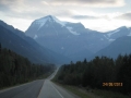
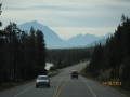
Mount Robson is the most prominent mountain in North America's Rocky Mountain range; it is also the highest point in the Canadian Rockies. The mountain is located entirely within Mount Robson Provincial Park of British Columbia, and is part of the Rainbow Range. Mount Robson is the second highest peak entirely in British Columbia, behind Mount Waddington in the Coast Range. The south face of Mount Robson is clearly visible from the Yellowhead Highway (Highway 16), and is one of the most photographed features along this route. Mount Robson was likely named after Colin Robertson, who worked for both the North West Company and the Hudson’s Bay Company at various times in the early 19th century. The Texqakallt, a Secwepemc people and the earliest inhabitants of the area, call it Yuh-hai-has-kun, The Mountain of the Spiral Road.[4] Other unofficial names include Cloud Cap Mountain.[2]
Geography[edit]

Mount Robson boasts great vertical relief over the local terrain. From Kinney Lake, the south side of the mountain rises 3,000 m (9,843 ft) to the summit. The north face of Mount Robson is heavily glaciated and 800 m (2,600 ft) of ice extends from the summit to Berg Glacier.
The north face can be seen from Berg Lake, reached by a 19 km (11.8 mi) hike. The lake is approximately two km long and lies at 1,646 m (5,400 ft) elevation. There are backcountry campgrounds at each end of the lake and a log shelter on its banks, named Hargreaves Shelter in honor of the Hargreaves family who operated the Mount Robson Ranch across the Fraser River from the mountain and who outfitted most of the early trips into Berg Lake. The Berg glacier calves directly into the lake. The Robson Glacier, which fills the cirque and valley between Mount Robson and Mount Resplendent, in the early 1900s fed directly into both Berg lake and Adolphus lake, straddling the Continental Divide and draining thus to both the Arctic and Pacific oceans via the Smoky and Robson Rivers, respectively. It since has receded more than 2 kilometres and is the source of the Robson River only.
Climbing[edit]

The 1,500 m (4,921 ft) Emperor Face on the northwest side provides the most formidable challenge to elite climbers on the mountain, though the more popular routes are the Kain route and the southeast face. The Kain route follows the first ascent's path up the entire length of the Robson Glacier from its terminus above Robson Pass to the upper northeast face and the summit ridge. Mount Robson has a high failure rate on climbing to the top, with only about 10% of attempts being successful. Although the mountain is under 4,000 m (13,123 ft), there is no easy way to the summit and bad weather commonly rebuffs most summit attempts.[1] The first ascent of Mount Robson, for its time the hardest ice face to be climbed on the continent, was an expedition organized by a large party of Alpine Club of Canada members led by the young guide Kain, who made use of the newly completed Grand Trunk Pacific railway to access the area, though a few intrepid explorers had made previous attempts at the summit. The most famous early ascensionist was the Reverend George Kinney, a founding member of the Alpine Club, who on his twelfth attempt in August 1909 is presumed to have reached the high summit ridge with local outfitter Curly Phillips before being turned back. Kinney Lake, below the south face, is named in his honour.
The main routes on Mount Robson include:[2]
- South Face (Normal Route) IV
- Kain Face IV (named after Conrad Kain)
- Wishbone Arete IV 5.6
- Emperor Ridge V 5.6
- Emperor Face, Stump/Logan VI 5.9 A2
- Emperor Face, Cheesmond/Dick VI 5.9 A2
- Emperor Face, Infinite Patience VI WI5 M5 5.9
- Emperor Face, House-Haley M7
- North Face IV
- Fuhrer Ridge IV 5.4
 Canadian Rockies (3) - Athabasca Glacier, Alberta
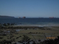
 Canadian Rockies (1) - Valemount, British Columbia